 NERC Data Catalogue Service
Volcanic activity
Type of resources
Topics
Keywords
Contact for the resource
Provided by
Years
Formats
Representation types
Update frequencies
-
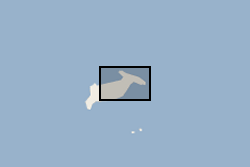
Waterlines have been extracted to delimit the edge of the Hunga Tonga - Hunga Ha'apai island between April 2017 and April 2022. Waterline is defined as the instantaneous land - water boundary at the time of the imaging process. Waterlines have been generated by BGS - Earth Observation team through a thresholding-based classification based on Sentinel-2 multispectral imagery and developed on Google Earth Engine. Specifically, the thresholding has been applied to the Normalized Difference Water Index (NDWI) has been derived as a basis to discriminate between the land and sea based on their spectral characteristics. Changes in waterlines over volcanic islands can provide key information to understand volcanic processes. For more info on the methodology, see Novellino et al. (2020) https://doi.org/10.3390/app10020536
-
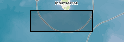
Our proposed research is based on cores collected during the recent, and very successful, Integrated Ocean Drilling Program (IODP) Expedition 340. The aims of this expedition were to investigate the volcanism and landslide history of the Lesser Antilles volcanic arc, by collecting a number of cores offshore Montserrat and Martinique. As a shipboard planktic foraminifera (single celled calcareous plankton) biostratigrapher (dating sediment cores using the appearances and disappearances of fossil plankton), Deborah Wall-Palmer (proposed PDRA) has access to these cores during the one year moratorium period. Until IODP Exp. 340, the longest continuous record (~250,000 years) of volcanic activity on Montserrat was a 5.75 m core collected to the south-west of the island in 2002, CAR-MON 2. This core revealed a more extensive and complete record of volcanic activity than that available in terrestrial cores. The longest continuous sediment record collected during Exp. 340 extends this record considerably. At 139.4 m in length, Hole U1396C records events back to 4.5 million years ago. The majority of this Hole will undergo stratigraphic analysis at low resolution, which will be carried out by other Exp. 340 scientists (Andrew Fraass, Mohammed Aljahdali). The upper 7 m section of this Hole is estimated to span 300,000 years and is comparable to the time period recovered in sediments for Holes U1394A/B (0 to 125 cm) and U1395B (0 to 30 cm). Holes U1394A/B and U1395B were collected close to Montserrat, in the main path of eruptive material from the Soufriere Hills volcano and contain a high resolution, but interrupted record of volcanic eruptions and landslides. Our proposed research is to provide a high resolution (every 2000 yrs) age framework across the upper ~300,000 year sections of these three cores. This will be achieved by collecting specimens of the planktic foraminifera Globigerinoides ruber and analysing the stable oxygen isotope ratios contained within their calcium carbonate tests (shells). Oxygen isotope ratios provide information about the global ice volume and global climate, and the standard record can be identified world-wide. Correlation to this record can therefore be used to provide an age framework for sediments, which is more detailed than using the biostratigraphic range of species alone. Producing this age framework is essential for achieving the overall aims of Exp. 340 as it will be used, in collaboration with several other Exp. 340 scientists, to reconstruct the volcanic and landslide history of Montserrat. In addition to this, to ensure the conservative use of samples, some further work will be carried out on samples requested from the upper 7 m of Hole U1396C. This will assist in constructing the low resolution stable isotope and biostratigraphic framework for the remainder of this Hole. The majority of this work is being carried out by Andrew Fraass (University of Massachusetts) and Mohammed Aljahdali (Florida State University). We will analyse the upper 7 m of Hole U1396C, at low resolution, for stable oxygen isotopes of the benthic foraminifera Cibicidoides spp. and for planktic foraminifera datum species.
-
In this urgency proposal we will deploy seismometers for 1 year to record aftershocks from sequence of 4 major earthquakes with magnitudes between 7.1-7.6. These recordings and other recordings of earthquakes from around the globe will allow us to delineate with high accuracy the plate interfaces of the new and old subducting slabs and image the slab structures at depth. The structure of the old and new subduction zones will illuminate the processes occurring at depth which are shifting the force balance in the region to reverse the sense of subduction. The proposed experiment will be enhanced by concurrent studies scheduled to be deployed in Fall of 2014, which includes a multimillion pound ocean bottom seismic deployment by colleagues in Japan. The combined array will allow us to image the Pacific plate which is stalling the subduction, allowing us to investigate what conditions are necessary for a plate to halt the descent of the slab into the mantle. Thus we will be able to understand how subduction stops and starts. Data available online at the Incorporated Research Institutions for Seismology (IRIS) Data Management Centre (DMC).